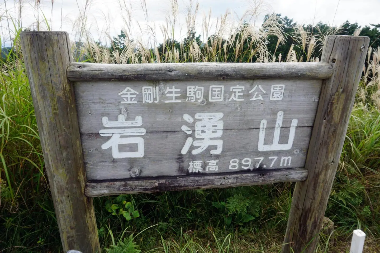
Iwawaki-san is a wide, flat-topped mountain in the far south of Osaka, marking the border between Osaka and Wakayama Prefectures. It is a popular destination for family hikes throughout the year since the trails are not particularly challenging.
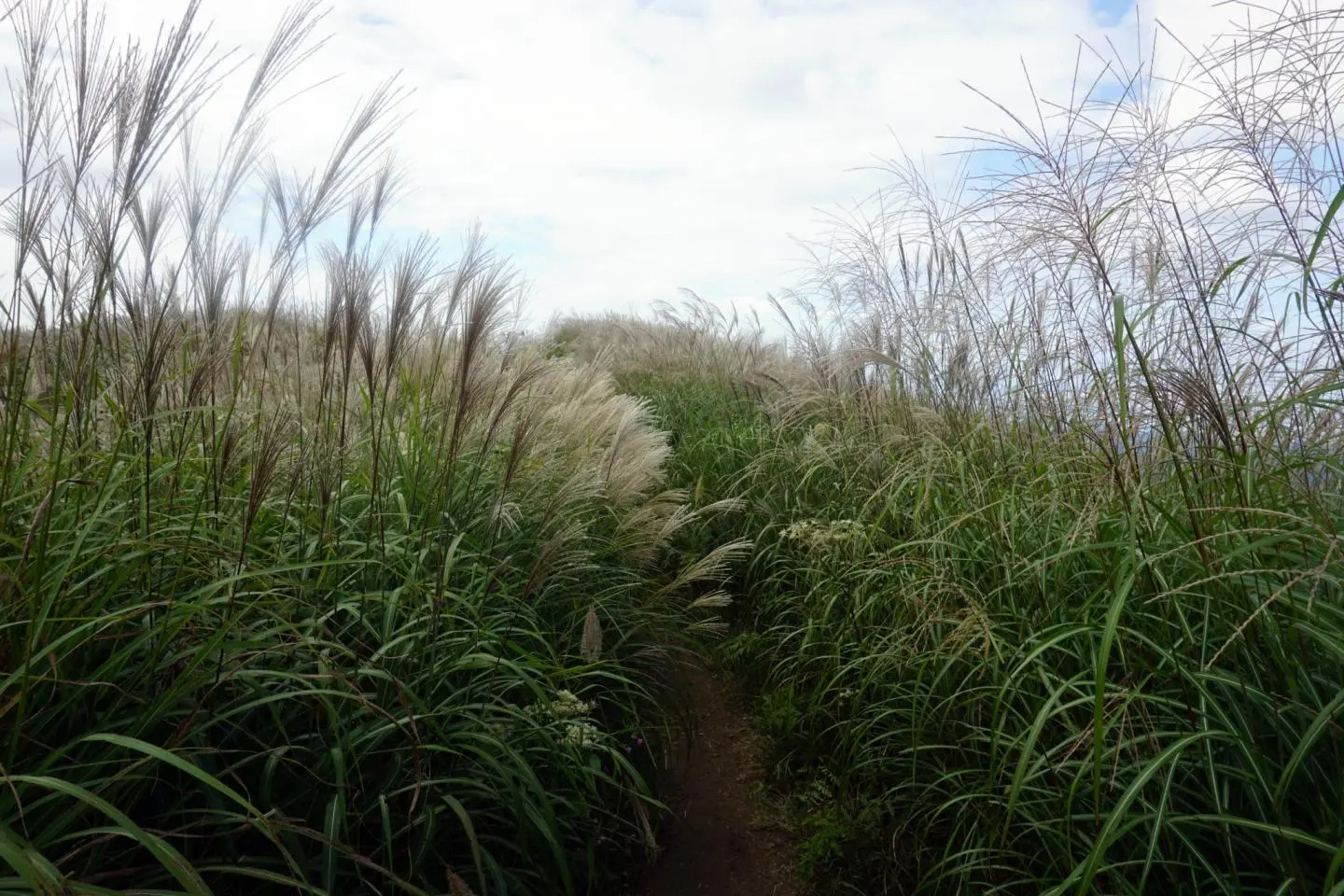
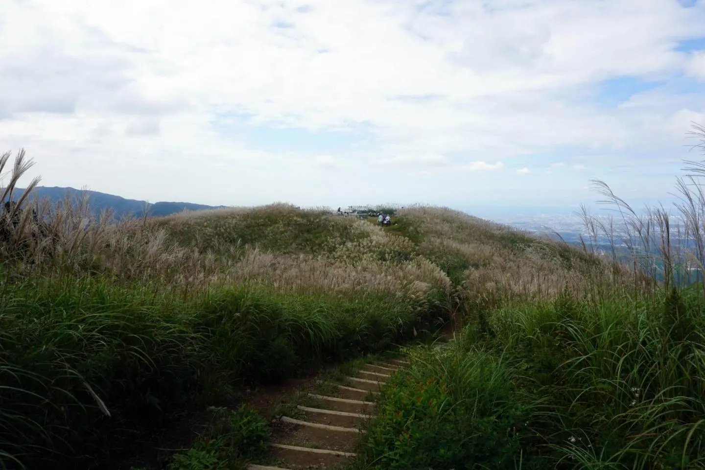
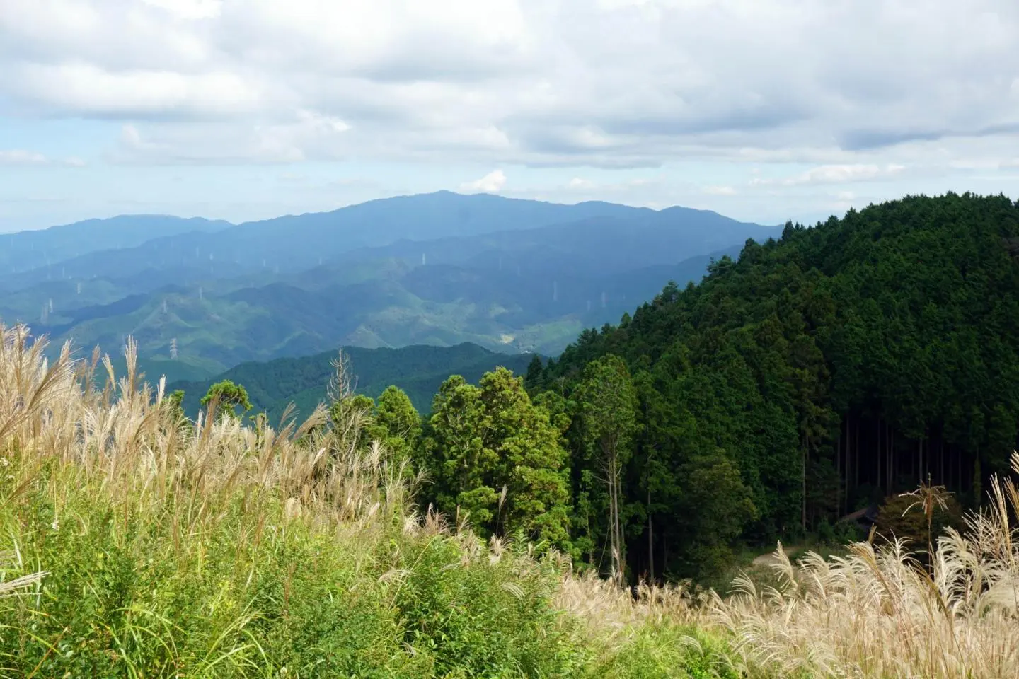
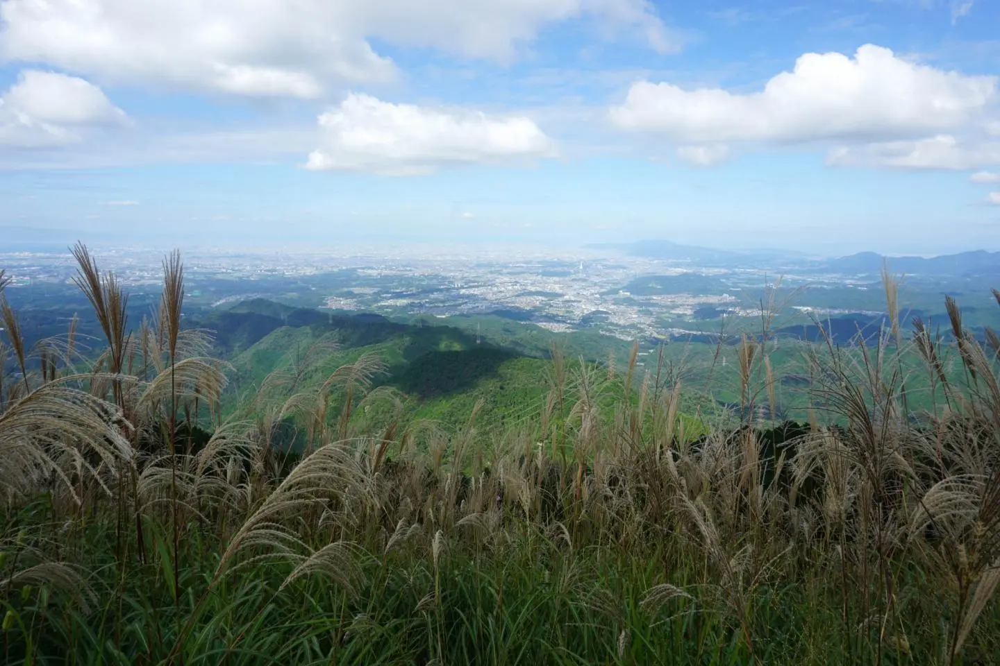
But the best time of year to climb Iwawaki-san is Autumn. The plateau is covered by a huge field of susuki (pampas grass) which waves gently in the wind. In November it is also an excellent spot to appreciate the Fall foliage, and when the weather is clear, its 897m summit offers an impressive view of Osaka.
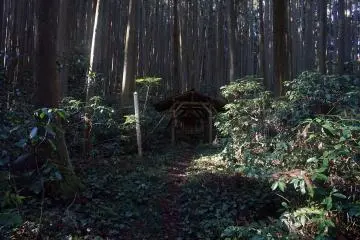
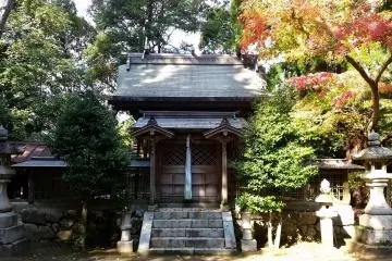
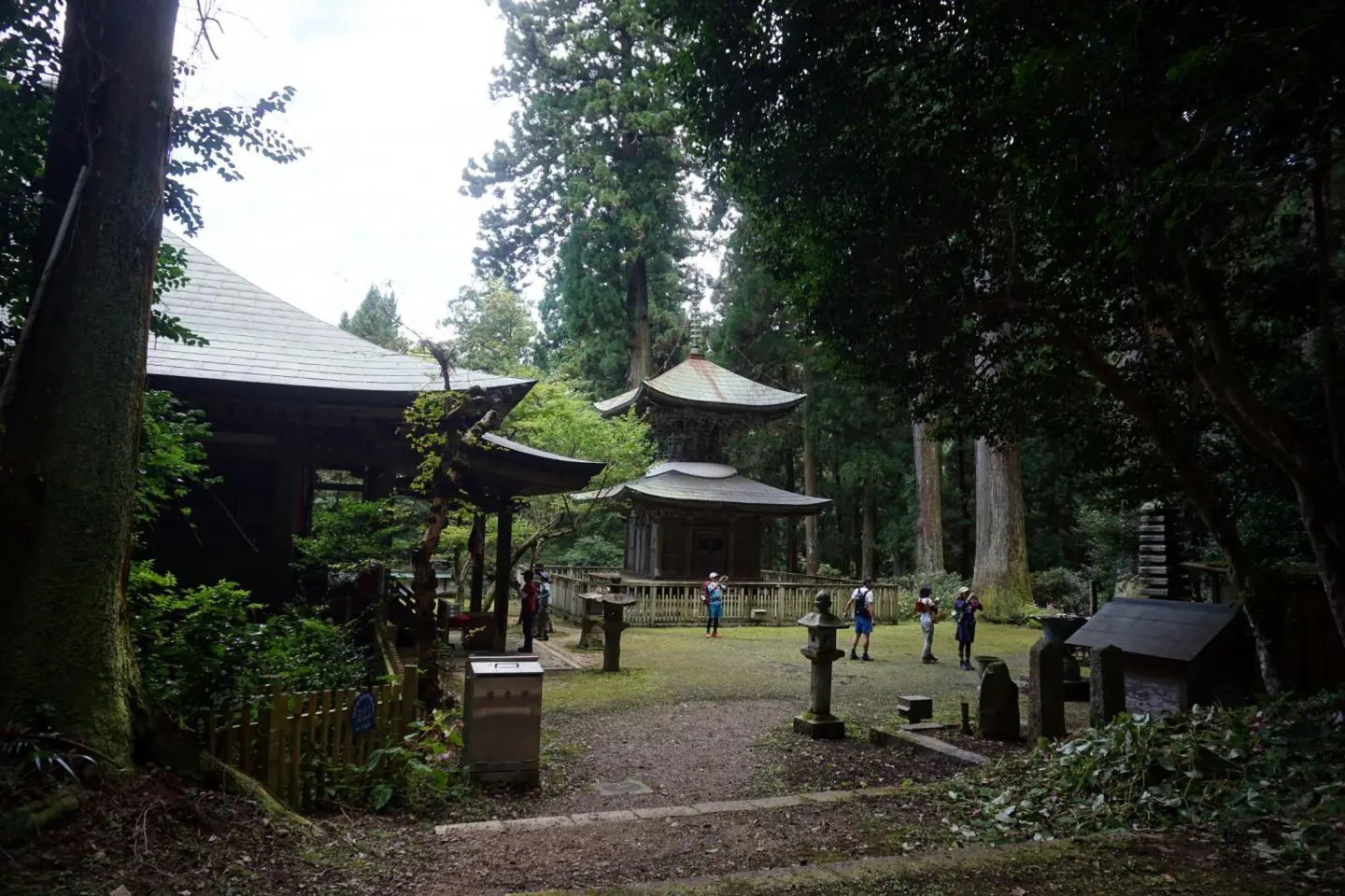
The trail head begins a short distance behind the mysterious temple, Iwawaki-dera. This peaceful temple and its mossy courtyard are surrounded by huge and ancient cedar trees. The rugged looks and dark woods give the impression that this 400 year old temple is unmanned but the grounds are still well maintained. Iwawaki-dera is small, just a hall and a two storey pagoda but it also has several interesting stone monuments dotted around the edges.
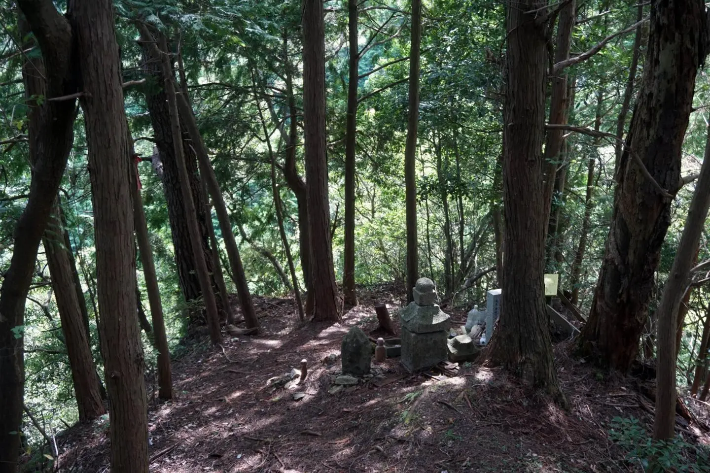
Following the road for a few hundred meters passed the trail head, you can also find one of the unusual Katsuragi 28 Shuku Kyozuka; if you know where to look. 15th of the 28 stopping points along this ancient Shugendo pilgrimage trail, it stands vigil on the edge of a small, rocky outcrop overlooking the temple but the sign that marks its entrance is barely visible and the pathway hard to spot.
Back at the trailhead and the way to the summit almost immediately splits in two. The right branch is the more direct route, taking approximately one hour. The left route is a little more challenging and takes about 90 minutes as it sweeps up and around the front of the mountain. Both routes meet at a junction just before the summit.
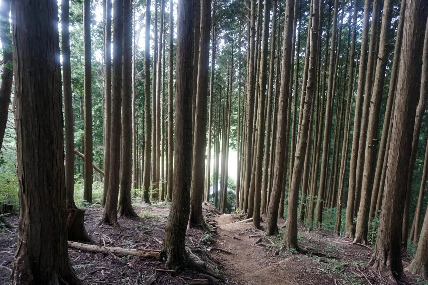
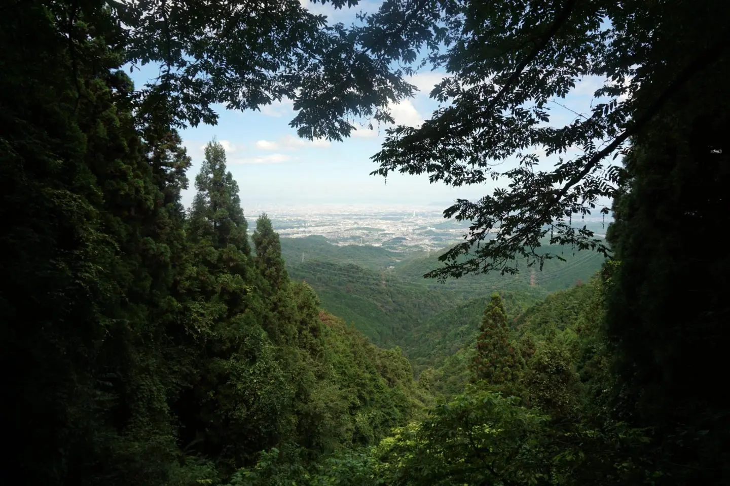
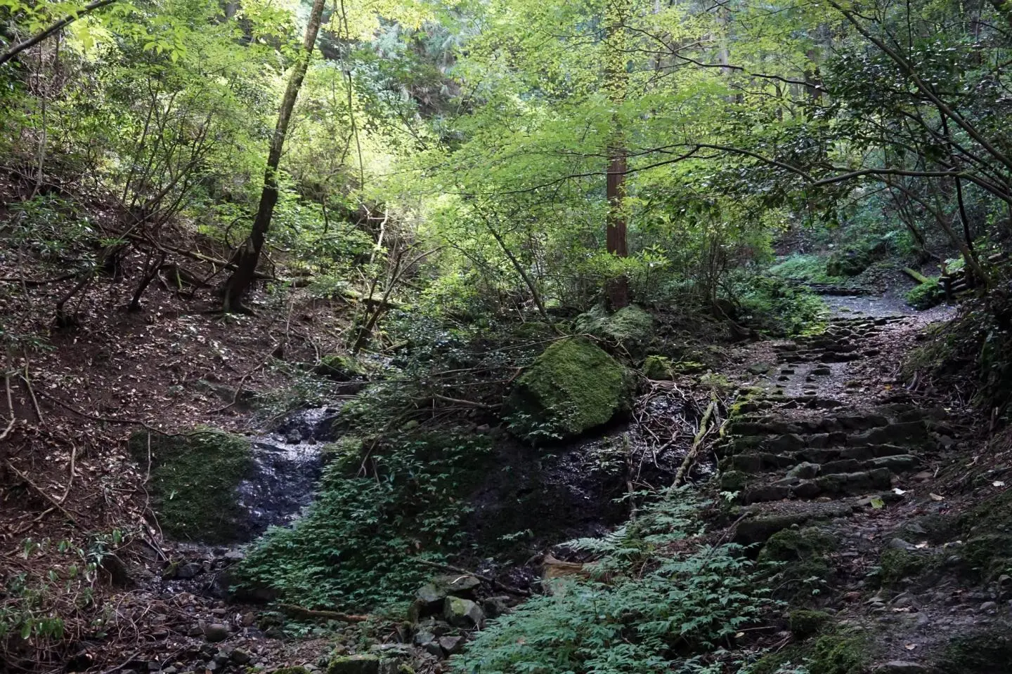
The more challenging route starts off on a relatively wide path with the occasional wooden steps. For a short while, it follows a stream that flows down the mountain. About one third of the way up is a wooden platform with a few benches that acts as both rest stop and viewing platform. To reach the platform, one needs to scrabble a couple of meters up a slippery section of path where the stream crosses from one side to the other. Through a break in the trees, the view is quite impressive, even from this level.
From this point, the path gets a little narrower and more windy until it eventually ends at a junction. Here the path meets the Diamond Trail, a long hiking route starting from Mount Makio to the west and ending at Mount Nijo to the north. Turning left, you would eventually reach Iwawaki-san’s nearest neighbour, Mount Kongo. Turning right leads you along a wide ridge that eventually brings you to the summit.
As you descend down a final set up wooden steps, the dense woodland surrounding you gives way to bright sunshine. Here stands a small public toilet and a narrow path up through the susuki to the summit proper.
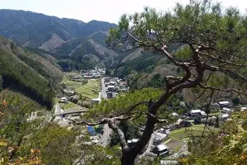
The view from the top of Iwawaki-san is impressive indeed. On the clearest of days, not only can you see the whole of Osaka Prefecture laid out before you, but you can also see across the bay as far as Kobe and the east coast of the island of Shikoku. You can also clearly see Mount Kongo and the next mountain in the series, Mount Katsuragi.
The path through the susuki opens out into a small clearing with several benches upon which to rest and eat lunch. There are also several maps of the area including one set into a stone plinth. Once you have rested up and had your fill of the view, you have two options. Either you can head back down to Iwawaki-dera via either of the two paths, or you can continue across the summit and head west towards Takihata Dam and Mount Makio.
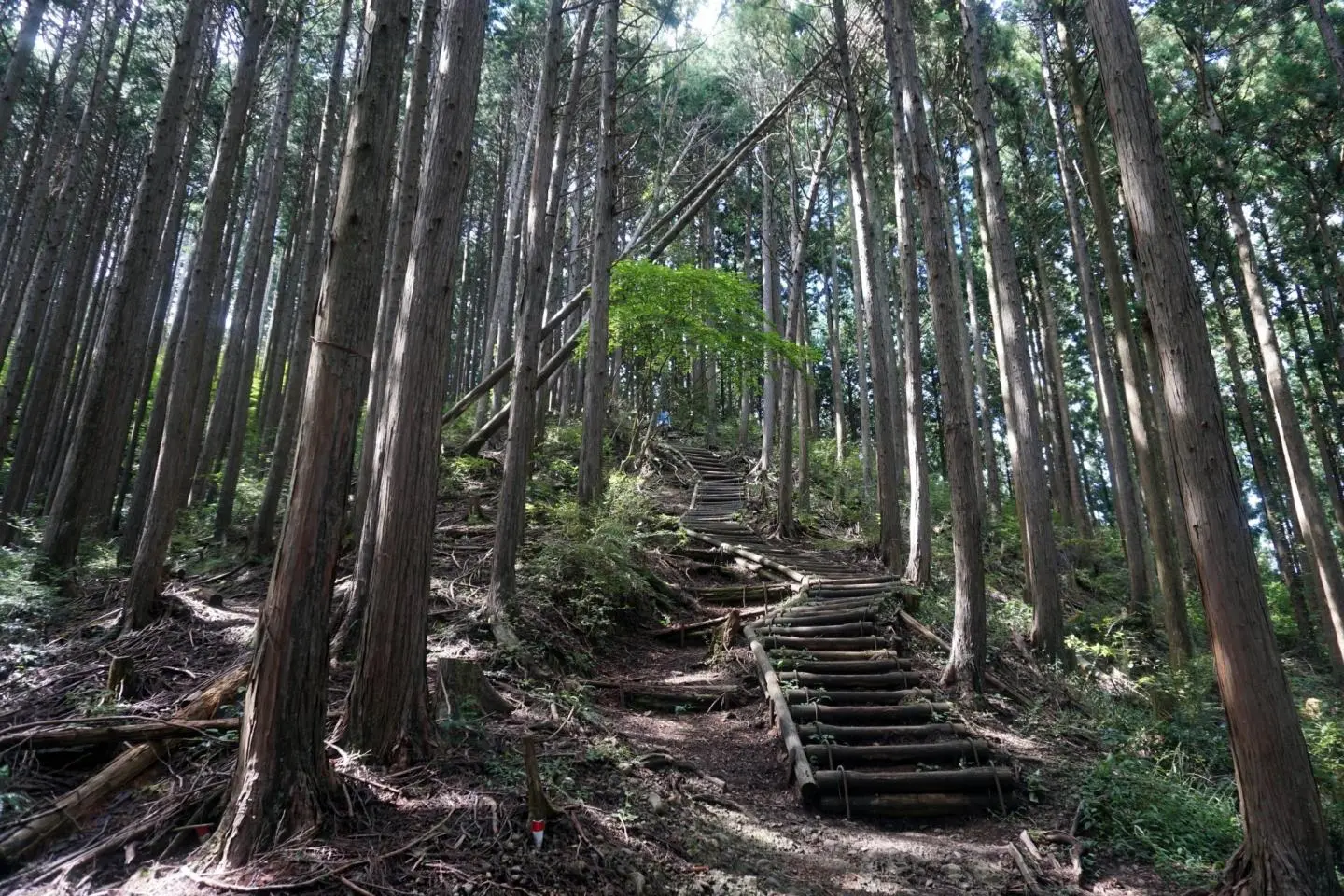
Descending Iwawaki-san by the shorter of the two routes takes you back to Iwawaki-dera down a winding log staircase. It can get a little steep and slippery in places but overall this route is an easy and fast way down the mountain. It is a less interesting route compared to its longer counterpart though as there are few breaks in the trees and few changes in the scenery.
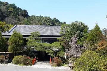
Next to the temple, at the bottom of the trail, is Iwawaki-no-Mori, a rest stop and information center with bicycle parking and public toilets. It also has a wooden terrace with benches that is a popular spot for bird watching.