The Tokyo area part of the Kanto Fureai no Michi stretches for 1665 km (1034.58 miles) over seven different prefectures: Tokyo metropolis, Saitama, Gunma, Tochigi, Ibaraki, Chiba, and Kanagawa.
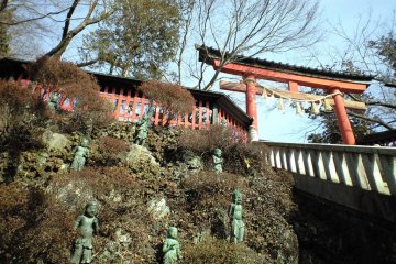
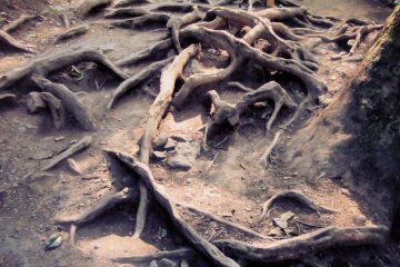
Like the rest of the Kanto Fureai no Michi, the Tokyo area trails were laid out to take in not only Japan's natural but also cultural heritage. Starting from the southern part of the western, and mountainous, half of Tokyo metropolis, the trail begins near the easily accessible world heritage site of Takao San, then travels a little way along the old Tokaido. Afterwards, the trail departs from civilization for a couple of segments as it meanders north through the mountains. The last two segments of the Tokyo area portion of the trail system are in Ome city, the Tama river valley and Mt. Mitake with its wonderful shrine and ancient cedars.
Part 1: The Lake Trail
(16.2 km, 10.07 miles)
- Ume no Ki Hira
- Misawa Touge
- Dai Tarumi Touge
- Ichi Chou Taira
- Takaosan
- Takao Yamaguchi Eki
Part 2: The Bird Trail
(19.4 km, 12.05 miles)
- Takao Yamaguchi Eki
- Takaosan
- Shiroyama
- Kobotoketouge
- Kagenobuyama
- Jinbayama
- Jin Ba Kougen Ka
Part 3: The Fuji Trail
(14.7 km, 9.14 miles)
- Jinba Kougen Ka
- Wadatouge
- Daigo Maru
- Ifujisan
- Kumakurasan
- Asama Touge
- Kamigawa Jou
Part 4: The History Trail
(8 km, 4.97 miles)
- Kamikawa Jou
- Asama Mine
- Seto Sawa
- Ji Saka Touge
- Haraizawa no Taki
- Kita Akikawa Kyou
Part 5: The Waterfall and Stalactite Cave Trail
(9 km, 5.59 miles)
- Kita Akikawa Kyou
- Sen Soku
- Tengu no Taki
- Aya Taki
- Fujimidai
- Ootaki
- Jou Youzawa
Part 6: The Shade of Cedars Trail
(11.5 km, 7.15 miles)
- Ue Youzawa
- Youzawa Shounyuudou
- Bi no Deyama
- Mitakeyama
- Ontake Keikoku
- Mitake Eki
Part 7: The Mountain Grass Trail
(13.1 km, 8.14 miles)
- Mitake Eki
- Sou Takeyama
- Iwatakesan
- Gonjiri Touge
- Bounomine
- Hyaku Ken Chaya
- Jou Hinata
It is possible to download maps for parts 3, 4, 5, and 7 from the main Japanese website servicing the trails. Maps for trails 1 and 2 can be found at both Takao Sanguchi and Mitake stations' information centers. The visitor information center near Mitake station in Ome city near the northern end of the trail system (for Tokyo that is) is the best place to get maps for the Tokyo area parts of the Kanto Fureai no Michi. Unfortunately, the visitor information center in Shinjuku could not do more than print off a couple of pages from the official website when I went there. It could also be possible to buy maps of the Fureai (nature) trails of individual cities at bookstores.