The Shade of Cedars trail gets its name from the giant cedars that line the trail and narrow road up the mountain to Mitake shrine. This 11.5 km (7.15 miles) trail begins (or ends depending on which direction you are going) at reclusive Ue Youzawa (上養沢) and ends at the extremely accessible Mitake station. Around Ue Youzawa the trail follows the road after the bus stop for a little ways, but there are some great examples of traditional style Japanese houses and gardens along the way.
After the trail goes up into the forest it meanders along the mountainsides for some great views and one rather derelict rest area. Up and over the ridge there is a sub-trail that goes down to a hot spring, the trail itself goes up a to a mountaintop that looks like it was once a small mountain fortress. From there the trail descends to another rest area for hikers then climbs up Mitake mountain.
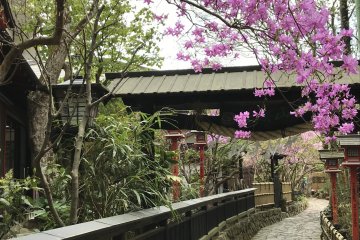
On top of Mitake is the excellently preserved Mitake shrine. Though fantastic early Edo era architecture, great history, awesome wolf guardian and samurai statues, and extraordinary national cultural significance aside… within the shrine is one of the three best suits of Japanese armor in the world.
Descending from the mountain is a trail/roadway (so watch out!) that is lined by ancient giant cedars. The traveler can take the cable car down (or up) for a small fee. At the base keep walking and come to the main road and cross it. The trail continues on and comes to a walking bridge over the Tama river. Follow the signs down the river and come up to Mitake station (be careful… you have to hike a short ways out of the river area). The Tama river valley and its walk way are a beautiful one day excursion all by themselves.
The Shade of Cedars trail is part of a regional network of trails collectively known as the Kanto Fureai no Michi (pronounced like Kantoe foo-leh-ai no meechee), which covers the provinces of Tokyo metropolis, Saitama, Kanagawa, Chiba, etc. It is divided into 144 segments that can be taken one or two a day. This is the sixth of seven coming from the south. Ue Youzawa is accessible by buses coming from Musashi Itsukaichi station, from which the traveler can reach Shinjuku station in Tokyo easily, and Mitake station is of course serviced by regular trains.
It is highly advisable for the traveler to get a trail map from the information center just outside of Mitake station. It has all the maps for the Tokyo area Kanto Fureai no Michi. The person at the information center is very friendly and will provide the traveler with a lot more information than they really need if it’s a slow day.